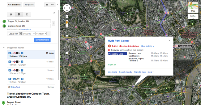
Google has added live updates for the London Underground to its Maps service in anticipation of the hectic nature of public transport during the upcoming Olympic Games.
The company recently announced it would be providing real time updates for all of the London tube lines ahead of a busy summer in London. Maintenance and general service information can be found for individual lines as well as tube stations on smartphones, tablets and of course, the regular Google Maps website.
Google says the information will be updated every 30 seconds, so you’ll always be able to see the latest information before you take a journey on the tube. The information is provided by Transport for London, who has recently added live information on its London bus services to its website. Many apps are already using the bus information to compliment updates on the London Underground service, but Google is yet to add the information to Maps.
Users can now view the latest service updates on underground stations and tube lines by using Google Maps to ‘Get Directions’, selecting the public transport option to view tube routes and stations. A simple click on a tube station or line on the map will tell you if the station is operating normally or if there are any alerts, for which you can view detailed information. For instance, today we clicked on the Hyde Park Corner tube station to see that 1 alert was affecting the station – after clicking for more info we’re told there are significant delays on the Piccadilly Line – nice and easy.
Live updates for London Underground are now available at google.com/maps as well as on Android devices in the UK, U.S, Canada, France and Australia. We expect Google to add the feature into its mobile apps for all platforms, including iOS, in the very near future.
Let us know your thoughts on our comments below or via our @Gadget_Helpline Twitter page or Official Facebook group.

