Google Maps has received a major overhaul thanks to new satellite imagery which was introduced this week.
The addition of 700 trillion pixels of new image data collected by the Landsat 8 satellite and by using digital combing to piece together a ‘cloudless’ mosaic means that the Google Maps satellite view and Google Earth are now crystal clear and in greater contrast than ever and these visually stunning images give us the best view yet of every mountain, canal and city street – you could literally see your house from here with the insanely detailed new view.
Previously the Google Maps imagery was supplied by the U.S government from its satellite Landsat 7 which was gathering the data since 2003. The upgraded Landsat 8 has taken over documenting duties more recently and the results are incredible. The algorithm to make the photos into a cloud-free tapestry was created in Javascript of all things.
The potential of this new look Google Maps offers more than just a bit of fun for us as general users, but also the scientific and geological benefits are beyond measure. The clarity of the image is greater than anything previously captured and offers a good look at where issues like deforestation is happening and helps document the extent of melting at the polar ice caps.
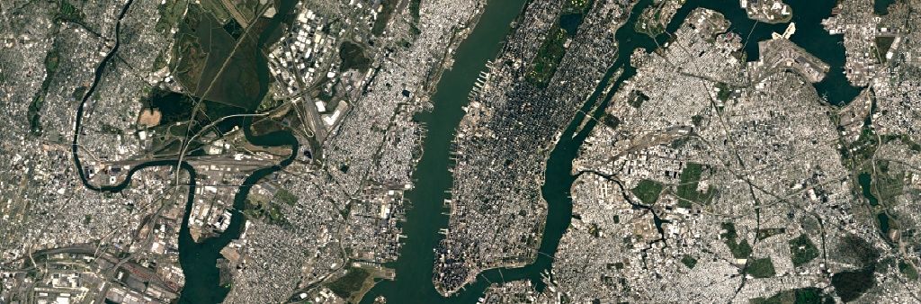
Take a look at these shots of New York, the first from the previous Landsat capture and the second from the new image overhaul. The results are outstanding.