Yesterday we wrote how Google Maps has now allowed us to explore some truly beautiful sights and European landmarks via its latest tour feature. Today the coin is flipped, as Google is releasing images from their satellite map service revealing the scale of the devastation caused by recent earthquakes and the tsumani in Japan.
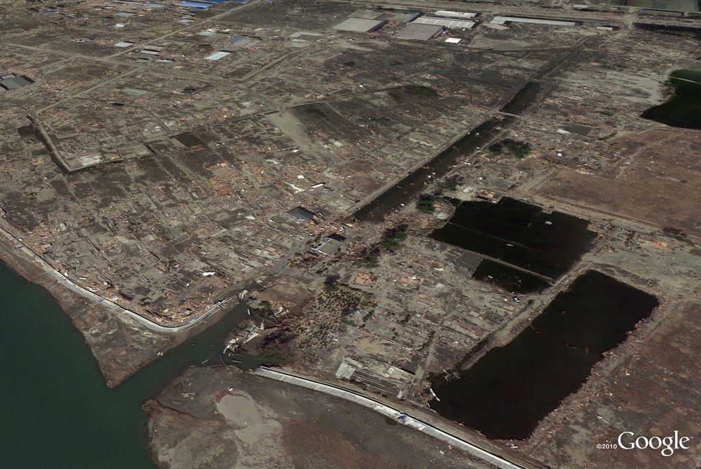
The earthquake struck three weeks ago sparking a series of tragedies which crippled the country, with Japan still so far from recovery. Google are providing the images so that the Maps service can be used help to Red Cross and other organisations desperately trying to administer aid by providing up-to-date high-definition photography of the areas most effected and to offer better understanding the conditions below.
Google posted a satellite image of the seriously effected Sendai region on its official blog yesterday and we’re truly shocked to see the aftermath of these disasters in such detail and we can only hope the shots can be used to further aide the relief efforts.
You can share your comments and thoughts on this or any of our other blog articles at the official Gadget Helpline Facebook Page!